|
|
|
![]()


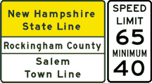
Speed Limit info on this page is courtesy
of Jeff Leadbeater, who was in the area in June 2002. This IS subject to change
at any given time, at the whim and fiat of NHDOT, so if you get nailed for
Warp 9 in a Warp 2, it's yet own fault, and you can't blame anybody but yourself.
You shouldn't be such a leadfoot, anyway. So there. Just the same, now I have
a good excuse to plug Jeff's
Florida Page, which you're now obligated to visit(Hit the link, it'll
open in a new window so you can switch back and forth between pages and double
yer enjoyment).
I wouldn't depend on this page for any kind of "official"
info.
All that Internet stuff is bogus anyway.
| |
||
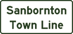
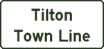
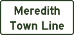
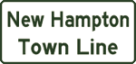
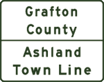
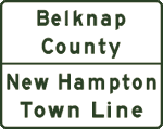
| Exit Description Points of Interest County and Town Lines |
Services |
|
| |
|
|
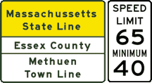
| Massachussetts |
||
| |
||
| |
||
New Hampshire
|
Massachussetts |
|
| New Hampshire
|
||
| New Hampshire |
||
| Rockingham Park Track |
|
|
RIGHT LANE EXIT ONLY |
||
| New Hampshire |
||
| Canobie Lake Park |
|
|
| |
|
|
| New Hampshire |
||
| Hudson |
|
|
| New Hampshire |
New Hampshire |
|
| New Hampshire |
||
| |
|
|
| |
|
|
| New Hampshire |
||
| White Pines College |
|
|
| New Hampshire |
||
| |
|
|
| |
|
|
| JUNCTION |
||
|
|
RIGHT LANE EXIT ONLY |
|
|
|
|
|
| New Hampshire |
||
| Candia
Rd Lee Scouting Museum Gill Stadium |
|
|
| USE |
||
RIGHT LANE EXIT ONLY |
|
|
|
|
|
|
| New Hampshire |
||
| Bridge
Street |
|
|
| |
|
|
| New Hampshire |
||
| Southern NH University |
|
|
| |
|
|
| |
|
|
| |
||
| New Hampshire |
||
| University Of New Hampshire |
|
|
| JUNCTION LAST EXIT BEFORE TOLL |
|
|
|
|
|
|
| New Hampshire |
||
| |
||
| New Hampshire |
||
|
|
|
|
| |
|
|
| New Hampshire |
||
| |
||
| New Hampshire
|
New Hampshire |
|
| JUNCTION Bow |
||
LAST EXIT BEFORE TOLL |
||
| |
|
|
| |
|
|
| New Hampshire |
||
| EXIT 12 A
EXIT 12B
|
|
|
| New Hampshire |
||
| Capital Center for the Arts |
|
|
| |
|
|
| New Hampshire |
||
| Museum of New Hampshire State Library |
|
|
| EXIT 15E
Christa McAuliffe Planetarium NH Technical Institute EXIT 15W
Museum of New Hampshire
|
|
|
|
|
|
|
| |
||
| New Hampshire |
||
| |
|
|
mile 42
|
mile 42 |
|
| New Hampshire |
||
| EXIT 17
|
EXIT 17E TO EXIT 17W
|
|
| |
|
|
| New Hampshire |
||
| TO Boscawen Shaker Village |
|
|
| New Hampshire |
||
| |
|
|
| New Hampshire |
||
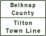
Tilton |
|
|
| |
|
|
| New Hampshire |
||
| |
|
|
| |
||
| |
|
|
| New Hampshire |
||
| New Hampshire |
||
| |
|
|
| |
|
|
| |
|
|
| New Hampshire |
||
| |
|
|
| |
|
|
| |
|
|
| New Hampshire |
||
| Squam Lake District |
|
|
| |
|
|
| New Hampshire |
||
| TO Plymouth State College Plymouth Historical Museum |
|
|
| |
|
|
| New Hampshire |
||
| |
|
|
| |
|
|
| New Hampshire |
||
| TO |
|
|
| New Hampshire |
||
| Convention Center |
|
|
| |
|
|
| New Hampshire |
||
| White Moutain National Forest |
|
|
| |
|
|
| New Hampshire |
||
| |
|
|
| New Hampshire |
||
| TO |
||
| New Hampshire |
||
| Kancamagus Highway White Moutain National Forest |
|
|
| |
|
|
| New Hampshire |
||
| |
|
|
| |
|
|
| Begin Franconia Notch Parkway |
END Franconia Notch Parkway
|
|
| New Hampshire |
||
|
|
|
| New Hampshire |
||
| |
||
| New Hampshire |
||
| Trail Head Car Park SHORT SLIP ROADS |
Lafayette Place Campground
SHORT SLIP ROADS |
|
| |
|
|
| New Hampshire |
||
| Boise Rock
The “Old Man of
The Mountain”, |
||
| New Hampshire |
||
| Trail Head |
||
| New Hampshire |
||
| Cannon
Mountain Tramway New England Ski Muesum |
|
|
| New Hampshire |
||
| Governor Gallen Memorial |
|
|
|
|
BEGIN Franconia Notch Parkway
|
|
| New Hampshire |
||
| White Mountain National Forest Mt Washington Cog Railway Great North Woods
|
|
|
| New Hampshire |
||
| |
|
|
| New Hampshire |
||
|
|
|
|
| New Hampshire |
||
| |
|
|
| |
|
|
| |
|
|
| New Hampshire |
||
| |
||
| New Hampshire |
||
| |
|
|
| |
|
|
| New Hampshire |
||
|
Artworks Gallery Art To Go Gallery |
|
|
| New Hampshire |
||
| |
|
|
| New Hampshire |
||
| |
||
| New Hampshire |
||
|
|
||
| |
||
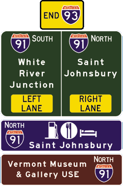
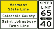
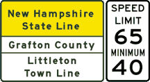
| Vermont
|
New Hampshire |
|
| Vermont |
||
| Vermont |
||
| |
|
|
|
|
|
|
| Exit Description Points of Interest County and Town Lines |
Services |
|
| |
||


| Exit description Points of Interest |
Services |
|
| |
|
|
| |
||
| RIGHT LANES
|
||
| |
||
| Mall of New Hampsire |
|
|
| |
||
| |
|
|
|
|
||
| |
|
|
| FIRST RIGHT-NORTHBOUND |
EXIT RIGHT-SOUTHBOUND |
|
| Bedford Mall: |
||
| Straight Ahead |
||
| |
||
| SECOND RIGHT NORTHBOUND |
Straight Ahead |
|
| |
||
| |
|
|
| |
||
| |
|
|
| |
||
| Granite Street Gallery at Langer Place Ingbretson Gallery Hatfield Gallery Hesser College |
|
|
| |
||
| Amoskeag
Bridge Singer Park Currier Gallery of Art Notre Dame College |
|
|
| |
||
| New Hampshire Tech College-Manchester |
|
|
| |
||
| |
|
|
|
STRAIGHT AHEAD TOLLWAY
|
|
|
| Exit Description Points of interest |
Services |
|
| |
||
| |
||
| Exit Description Points of Interest |
Services |
|
| |
||
| Museum of New Hampshire STRAIGHT AHEAD
SECOND RIGHT
FIRST RIGHT |
|
|
| |
||
| Fort Eddy Road Christa McAuliffe Planetarium NH Technical Institute |
||
|
|
||
| |
||
| State Offices |
||
| |
||
| Concord |
|
|
| |
|
|
| |
||
|
|
|
|
| Exit Description Points of Interest |
Services |
|
| |
||
Based on eXitsource for Palm®
listings, Streets and Trips 2k2,
Peter Woodman's IH 93 Site,
and ShadyJay's New England Turnpikes site(link is above)
NH sign not stolen from James Lin, nor are any of the others.
Everett Turnpike and other signs are my own creations and are not intended as
representations of the real signs. You know the drill by now, I hope. Fonts
used are FWHA Series "C" , "D" and "E" modified
from Chris Jordan.
As well as the "Roadgeek 2000" series fonts
which are so close to FWHA fonts, even yer mom can't tell the difference.
“Bruce”(at non-JN 21)stolen from MontyPythonPages.com
making this the only freeway junction list site that uses a Monty Python joke
in the whole world.


 NORTH TO


 TO
TO 


 SOUTH
SOUTH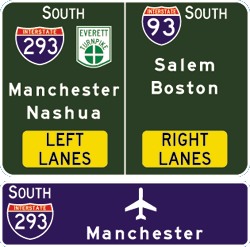
 Hooksett Toll Plaza
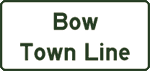


 WEST
WEST


 EAST
EAST


 TO
TO 


 joins
Parkway NORTH
joins
Parkway NORTH


 EAST
EAST
 NORTH TO
 TO
TO